Tuesday, 19 Mar 2024    Census The #1 Census Source for Genealogy & Family History HOME   
Census Records for Genealogists & Family Historians FREE Census Records Research Assistance at www.1930census.com
  HOME  »  U.S. Federal Census  »  1940 Census  »  1940 Map of the United States Sign In   
  U.S. FEDERAL CENSUS
  » 1950 Census
  » 1940 Census
     • 1940 Census Questions Asked
     • 1940 Map of the United States
     • In the year 1940
  » 1930 Census
  » 1920 Census
  » 1910 Census
  » 1900 Census
  » 1890 Census
  » 1880 Census
  » 1870 Census
  » 1860 Census
  » 1850 Census
  » 1840 Census
  » 1830 Census
  » 1820 Census
  » 1810 Census
  » 1800 Census
  » 1790 Census

  CENSUS BASICS

  U.S. STATE & CITY CENSUS

  INTERNATIONAL CENSUS

  RELATED CENSUS LINKS

  SEARCH THIS SITE


Google Your Family Tree - New Book for Genealogy


1930 Census

1940 Map of the United States

The map of the United States shown below displays the boundaries for each of the states that existed in year 1940 according to the United States Geological Survey Bulletin 1212.

Map of the United States of America

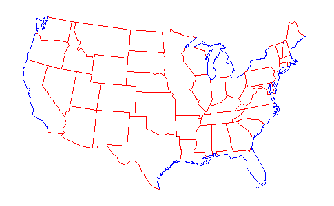
RED = Man-made Boundary    BLACK = Disputed Boundary

17901800181018201830184018501860
1870188018901900191019201930


The above maps courtesy of Ed Stephan of Bellingham, Washington, and were created in 1996 using information
he obtained from several composite maps in the United States Geological Survey Bulletin 1212
by Franklin K. Van Zandt, published by the U.S. Government Printing Office (1966).
For additional information or to view other images and animation by Ed, click here.


About Us  •  Contact Us  •  Advertising & Sponsorship  •  Privacy  •  Frequently Asked Questions  •  Helpful Links  •  Site Map  •  Home


Copyright © 2011-2022 by Daniel M. Lynch.  All Rights Reserved.

1950 Census | Google Your Family Tree | Immigration Records | Celebrity Genealogy | 1940 Census


www.1930census.com
Search This Site